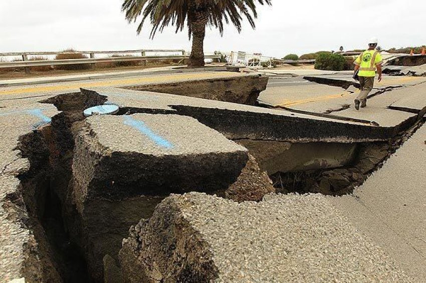
NASA mapped California cities that are sinking
U.S. west coastline subsidizes faster than ocean level rises.
Sea level rise isn’t just driven by melting ice caps—it’s also shaped by shifting land. A groundbreaking NASA-led study reveals that some parts of California’s coastline are sinking faster than the ocean is rising, amplifying local sea level rise.
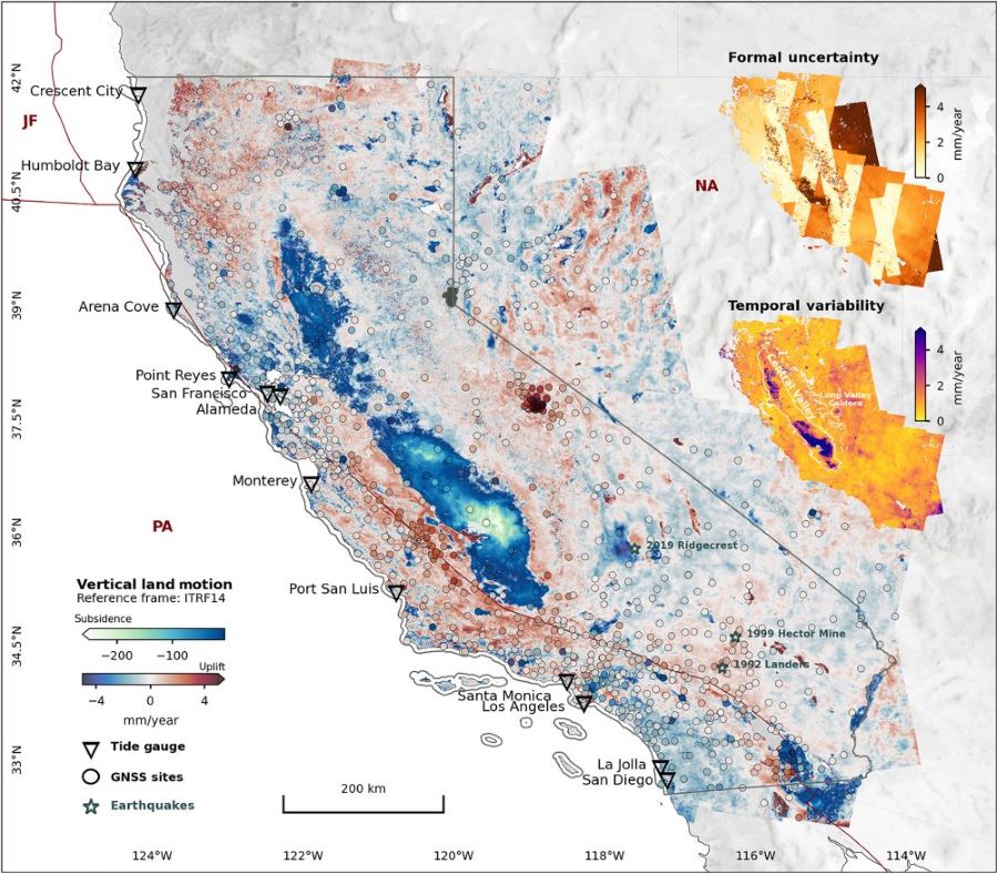
Using satellite data, researchers from the NASA Jet Propulsion Laboratory (JPL) and the National Oceanic and Atmospheric Administration (NOAA) identified areas where land movement—caused by human activities like groundwater extraction and natural forces such as tectonics—is altering the coastline unpredictably.
In locations like San Francisco Bay, land subsidence could push sea levels to more than double previous estimates. Conversely, regions like Santa Barbara are experiencing uplift, yet human activity introduces major uncertainties in predictions.
Forecasting sea level rise requires more than measuring ocean height—it also depends on how the land beneath us moves. Even minor shifts in land elevation can significantly impact local sea levels in the coming decades.
By 2050, California’s sea levels are projected to rise between 15 and 37 centimeters above 2000 levels due to melting glaciers, ice sheets, and warming oceans. However, coastal communities must also account for shifting land, with researchers suggesting the need to integrate land movement into future sea level projections – updating ultimately state planning and guidance.
Sinking cities
In many areas, such as the reclaimed land beneath San Francisco, the ground is sinking faster than the sea is rising, according to lead author Marin Govorcin, a remote sensing scientist at NASA’s JPL in Southern California.
The study reveals that vertical land motion varies in speed and scale, influenced by human activities like groundwater pumping and wastewater injection, as well as natural forces such as tectonic activity.
More to read:
[video] Remember Doomsday Glacier? A robot filmed trouble under it
Unlike tide gauge models, which have limited coverage, satellite observations capture land shifts across entire regions, offering more precise estimates of the movements shaping coastlines.
The researchers used satellite radar to track over 1,000 miles of California’s coastline, detecting rising and sinking areas in unprecedented detail. They pinpointed high-risk hotspots—including cities, beaches, and aquifers—facing greater exposure to rising seas.
By comparing observations from 2015 to 2023, they applied a processing technique known as interferometric synthetic aperture radar (InSAR) to refine their findings.
San Francisco Bay in subsidence
Focusing on the San Francisco Bay Area—including San Rafael, Corte Madera, Foster City, and Bay Farm Island—scientists observed land subsiding at a rate of more than 10 millimeters per year, primarily due to sediment compaction. Factoring in this subsidence, sea levels in these low-lying areas could rise over 45 centimeters by 2050—more than double the 19 centimeters projected using tide gauge data alone.
More to read:
World’s largest iceberg heading towards Atlantic Ocean island
Not all of California’s coast is sinking. The researchers mapped uplift hotspots of several millimeters per year in Santa Barbara’s groundwater basin, which has been replenishing since 2018, and in Long Beach, where fluid extraction and injection occur with oil and gas production.
However, human-driven land motion increases uncertainties in sea level projections by up to 40 centimeters in parts of Los Angeles and San Diego counties.
In California’s Central Valley, some areas are sinking as much as 20 centimeters per year due to excessive groundwater extraction. Periods of drought and heavy rainfall cause underground aquifers to shrink and expand, a pattern also observed in Santa Clara (San Francisco Bay Area), Santa Ana (Orange County), and Chula Vista (San Diego County).
More to read:
Researchers discover huge methane deposits in Norwegian permafrost. And they are “migrating”
Along rugged coastlines like Big Sur and the Palos Verdes Peninsula, researchers identified zones of downward motion linked to slow-moving landslides. Additionally, they detected subsidence trends in marshlands and lagoons around San Francisco and Monterey bays, as well as Sonoma County’s Russian River estuary, where erosion plays a significant role.
Understanding the combined impact of land movement and rising seas is essential for coastal resilience planning. With ongoing satellite monitoring, researchers continue to refine projections, helping communities prepare for the future.
***
NewsCafe relies in its reporting on research papers that need to be cracked down to average understanding. Some even need to be paid for. You can support us via PayPal: office[at]rudeana.com or https://paypal.me/newscafeeu, or https://buymeacoffee.com/newscafe - any amount is welcome. You may also want to like or share our story, that would help us too.


Copyright © 2021 All Rights Reserved.